How to use
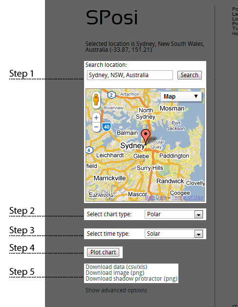
Step 1

Searching by city, state and country. For example, try searching for "Sydney, NSW,
Australia".
OR
Search using location coordinates. Latitudes north of the Equator are positive and
latitudes south of the Equator are negative. Longitudes east of the Prime Meridian
are positive and longitdues west of the Prime Meridian are negative. For example,
to find a location with coordinates 33.87°S, 151.21°E try searching for
"-33.87, 151.12".
OR
Drag the marker on the map to the desired location.
OR
OR
Step 2
Select a chart type from the dropdown menu.
Step 3
Select a time type from the dropdown menu.
Step 4
Click "Plot chart"!
Note:
SPosi
will try to retrieve time zone offset information automatically. However, some browsers
do not support this function and the time zone offset will have to be entered manually.
The time zone offset is the number of hours ahead or behind Coordinated Universal
Time (UTC). The offset is positive for time zones ahead of UTC and negative for
timezones behind UTC. Offset information is widely available and can be
found easily on the web.
Step 5
To download the Sun path data for a Sun path diagram click "Download data (csv/xls)".
To download the Sun path diagram as an image click "Download image (png)".
SPosi
will try and create an Excel file but depending on your browser this function may
not be available. If this is the case
SPosi
will produce the data in CSV format. To access the information in Excel copy the
data to Notepad and save the file with "data.csv" as the filename. The file can
now be opened in Excel.
SPosi
will then open a new window with the image. To save the image right-click on the
image and select "Save image as...".
Advanced options
Time zone offset override